Directional Drilling in St. Louis
America's two great rivers meet inside this metro — the Missouri surrendering to the Mississippi below the bluffs — with the Cave State's sinkhole-riddled limestone on one bank and the American Bottom's deep floodplain on the other. Gateway-to-the-West HDD is confluence drilling on two very different banks — and it's ours.
HDD is the whole job here
The confluence built two geologies and put a metro on both: the Missouri bank rides the Cave State's inheritance — Mississippian and Ordovician limestones, honeycombed by the karst that gives Missouri more mapped caves than any state and gives parts of St. Louis and Jefferson counties genuine sinkhole plains — all mantled in loess and residuum that varies the rock's depth block by block. The Illinois bank is the American Bottom: the Mississippi's great floodplain, deep alluvial sands and clays under East St. Louis and the levee-protected industrial flats, soft-ground engineering country where the bluffs at Belleville and Edwardsville mark the return to upland till. Bank-honest quoting — bedrock side or bottom side — is the metro's first estimating question, with the sinkhole map its second.
The market's infrastructure moment is generational: the regional sewer district's consent-decree program is among the nation's largest wastewater rebuilds — decades of tunnels, storage, and sewer separation reshaping the underground — while the water systems renew mains across a metro whose pipes remember the World's Fair. The economy stacks its own registers: the geospatial boom anchored by the new national agency campus rising in north city, defense-aerospace manufacturing at the airport's edge, the brewing-and-industrial heritage corridors, Scott Air Force Base commanding the Illinois side's federal presence, and the barge-and-rail logistics that made the riverfront America's inland port original. Bi-state means two of everything: MoDOT and IDOT, two One-Call systems, two state environmental machines — run through one desk as a single workflow, each side named per crossing.
And the city itself is Missouri's one independent city — county-free like Richmond's Virginia cousins, with its own full permitting world. Behind everything sits the network desk: 50,000+ boring calls answered, ~10,000 crossings quoted, 2,000+ drilled, pricing greater St. Louis with both banks already in the math.
Fiber-Optic Boring
Geospatial-corridor and campus duct, logistics laterals, and two-state FTTH.
Electrical Duct Boring
Feeders for campuses, industry, and two states' worth of renewing grid.
Water & Force-Main Boring
Pressure pipe for river-supplied systems in a generational rebuild era.
Confluence & River Crossings
The signature Gateway bore: the waters where America's two great rivers meet.
Road & Highway Crossings
The independent city, two DOTs, and the county quilts — bank-named and filed right.
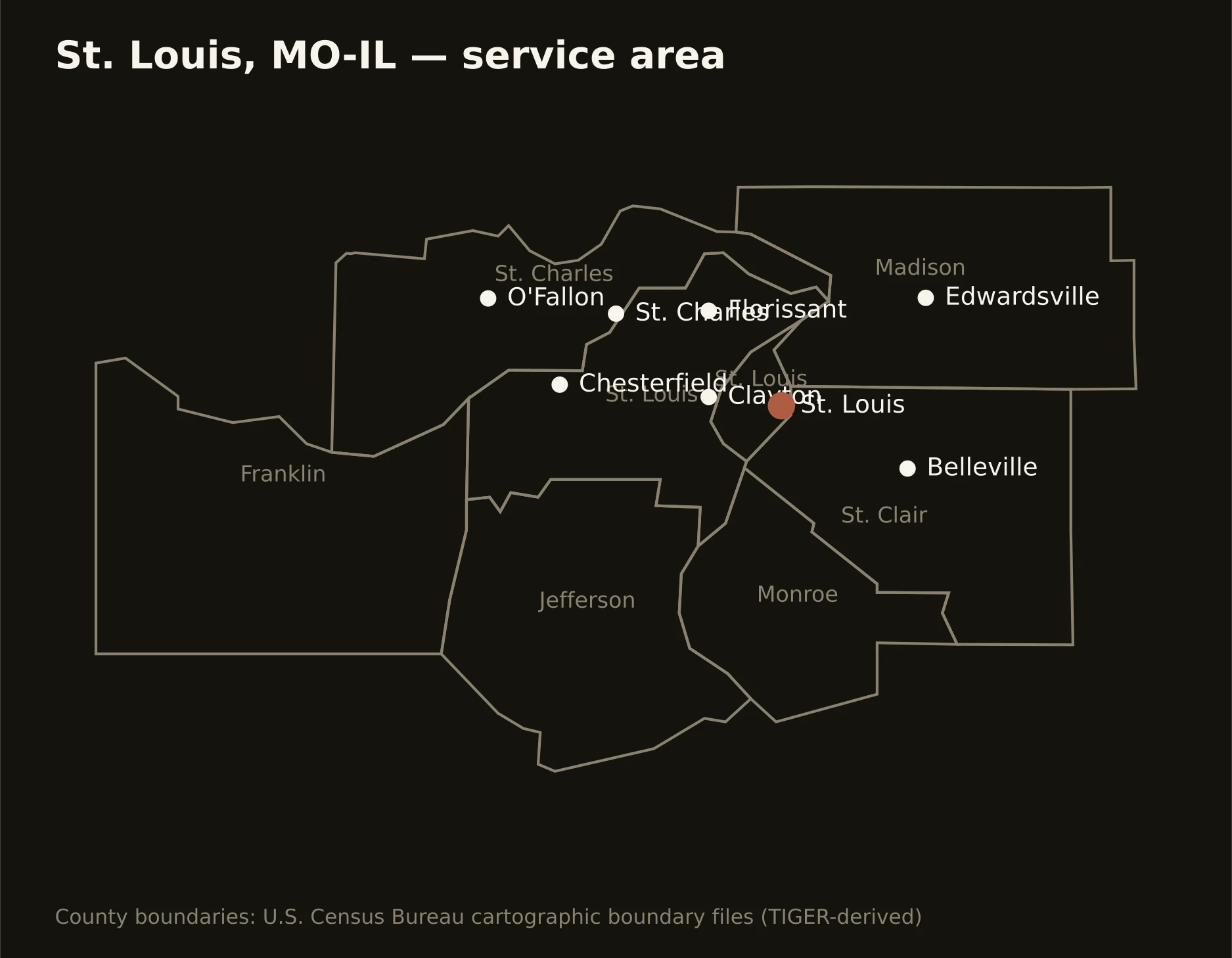
Eight principal jurisdictions across two states — the independent city on the river, St. Louis, St. Charles, Jefferson, and Franklin counties running the Missouri bank's hills, and Madison, St. Clair, and Monroe holding the Illinois bottom and its bluffs. Full county list on the service-area page.